Get maps from pixels
AI mapping from satellite imagery
Accelerate your workflow with AI using our imagery analysis and mapping platform. Join thousands of mappers and geospatial data analysts worldwide.

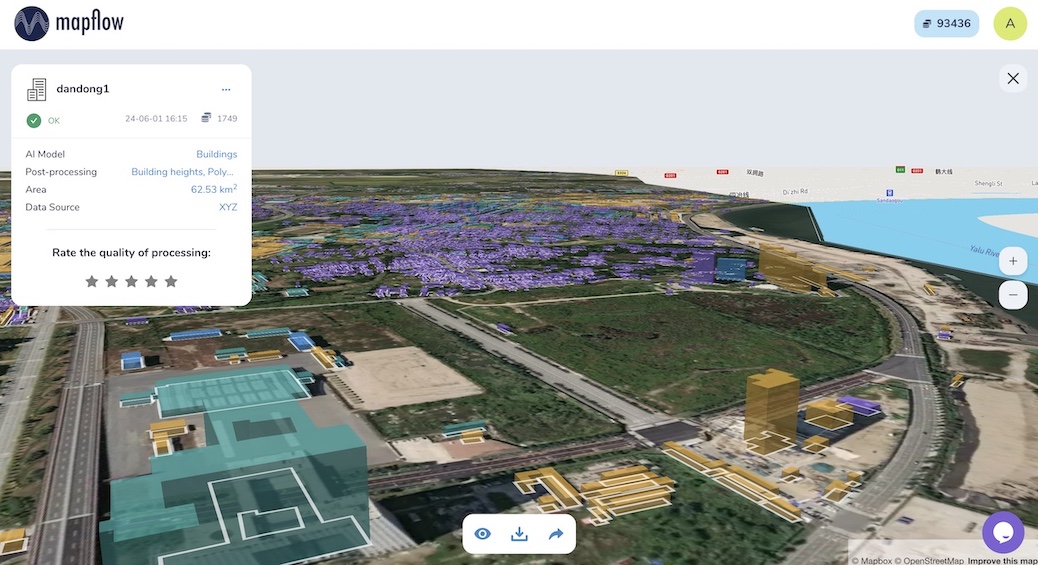
My Imagery updated! 🛰️ Organise your data collections and run AI workflows in one shot. 🚀
AI mapping from satellite imagery
Accelerate your workflow with AI using our imagery analysis and mapping platform. Join thousands of mappers and geospatial data analysts worldwide.
From semantic segmentation to agent-driven automation — Mapflow brings detection, large-scale validation, imagery management, and plain-language workflows together in a single place
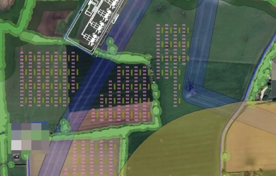
Detect and extract real-world objects — buildings, roads, vegetation, fields — as clean vector data enriched with semantic attributes
Run models across regions and whole countries, with human review built into the loop to keep results accurate as you scale
Connect leading data providers and organize satellite and aerial imagery into searchable, reusable collections
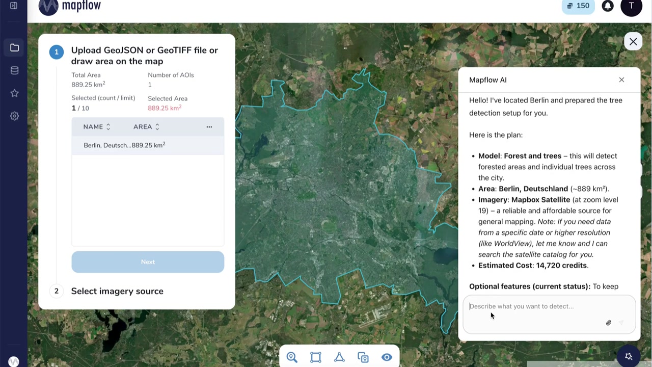
Describe what you need in plain language and let Mapflow Agent assemble, run, and refine the processing workflow for you
Use Mapflow the way that fits your team - in the browser, in QGIS, via chat, or through the API.
A browser-based workspace for uploading areas, selecting AI models, running processings, and visualising results on an interactive map - no installation required.
 New - Beta
Describe what you want to detect in plain language. The agent selects models, configures imagery, runs the processing, and explains the results - all in a chat panel on the map.
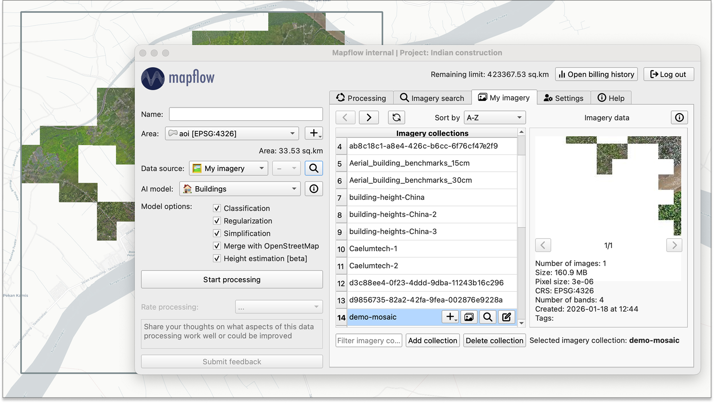
A QGIS plugin that brings Mapflow AI models directly into your desktop GIS. Draw your area, pick a model, and run server-side processing without leaving QGIS.
# 1. Create a project
curl -X POST https://api.mapflow.ai/rest/projects \
-d '{"name": "My First Project"}'
→ {"id": "project-uuid", ...}
# 2. Run processing
curl -X POST .../processings/v2 \
-d '{"wdName": "🏠 Buildings", "projectId": "project-uuid", ...}'
→ {"status": "IN_PROGRESS", ...}
# 3. Download results (when status = "OK")
curl .../processings/{id}/result \
-o results.geojson
A REST API for integrating satellite imagery analysis into your own applications and workflows. Access all AI models, imagery providers, and results programmatically.
Find out how Mapflow is used by our clients and partners
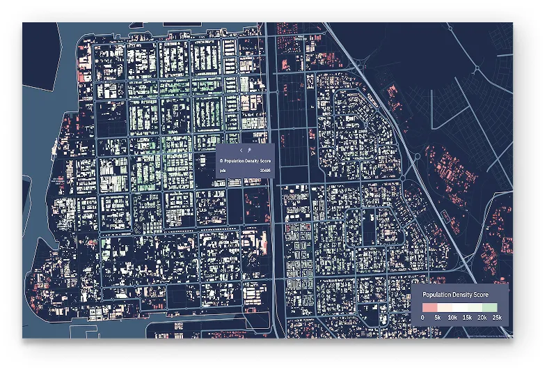
Countrywide dataset of detailed urban and population density maps was implemented into analytical workflow around disasters risk assessment. At the implementation phase our clients used Mapflow algorithms to detect buildings and their heights in residential areas. This allowed them to create a custom dataset distributing the population proportionately to the capacity of buildings in the spatial grid cell
 Darafei Praliaskouski, Head of Product
At Kontur we provide geospatial solutions for risk management using open data and extractions from satellite images. Geoalert helps us optimizing the mapping costs where the open data is limited or incomplete.