Карты вместо
пикселей
Ускорьте работу картографов и аналитиков с помощью платформы распознавания объектов на спутниковых снимках
Ускорьте работу картографов и аналитиков с помощью платформы распознавания объектов на спутниковых снимках
Мы обрабатываем спутниковые данные ведущих провайдеров, чтобы предоставить вам актуальную аналитическую информацию
Контуры зданий с типологией, высотами и расчетом проживающего населения
Классификация по породным характеристикам и высотам для лесного хозяйства и контроля охранных зон
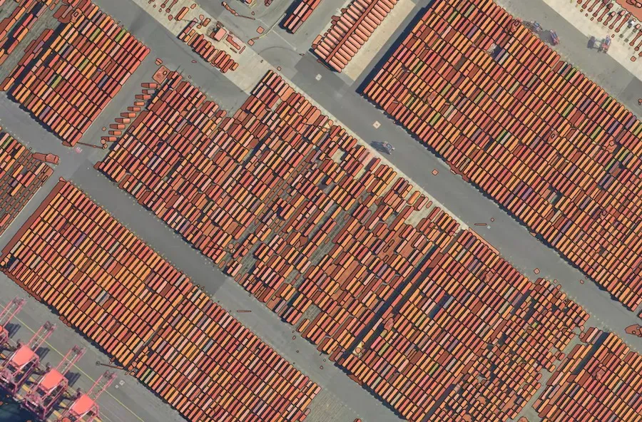
Детектирование строительных площадок и строящихся зданий для обновления карт и принятия решений
Выделение маски и классификация дорог для привязки треков и навигации
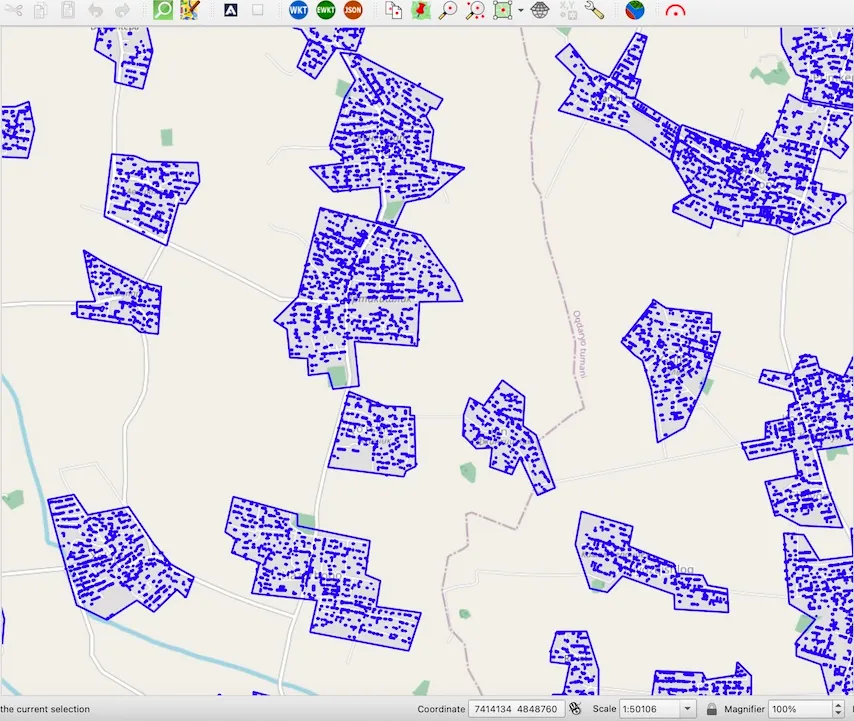
Сегментация и разделение отдельных сельскохозяйственных полей по спутниковым снимкам высокого разрешения
Универсальная предобученная модель сегментации. Дообучайте вашу объектную модель и запускайте с помощью Mapflow
Как платформа Mapflow используется нашими клиентами и партнерами
Mapflow позволет создавать датасеты в масштабах целой страны. Наши заказчики создают карты проживающего населения для решения бизнес задач, таких как размещение и оптимизация торговых сетей, а также для мониторинга ЧС и страхования возможных ущербов. Данные переписи населения интерполируются по территории пропорционально площадям жилых зданий и их этажности
 Darafei Praliaskouski, Head of Product
В Kontur Inc мы поставляем геоинформационные решения для мониторинга и управления рисками во время ЧС, используя открытые данные. Mapflow помогает нам не тратить много сил и времени на создание карт, там где открытые данные неполны или устарели.
Sep 5, 2023
In case you have many areas of interest to process or update, it can be boring to upload them one by one using Web or GIS user tools. In this case, you’d better think about using Mapflow Processing API.
July 7, 2023
While studying the META AI foundational model for image segmentation, we decided to try implementing it into the Mapflow platform and adjusting to the geospatial imagery processing workflows on a large scale.
February 26, 2023
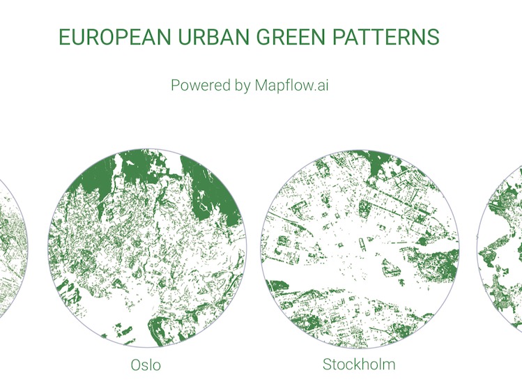
By using Mapbox satellite basemap and Mapflow AI-Mapping Platform, 45 urban green patterns were generated. From Reykjavik to Valletta, from Dublin to Kyiv, the tree cover for each European capital reflects a unique mix of human-nature interaction.
February 09, 2023
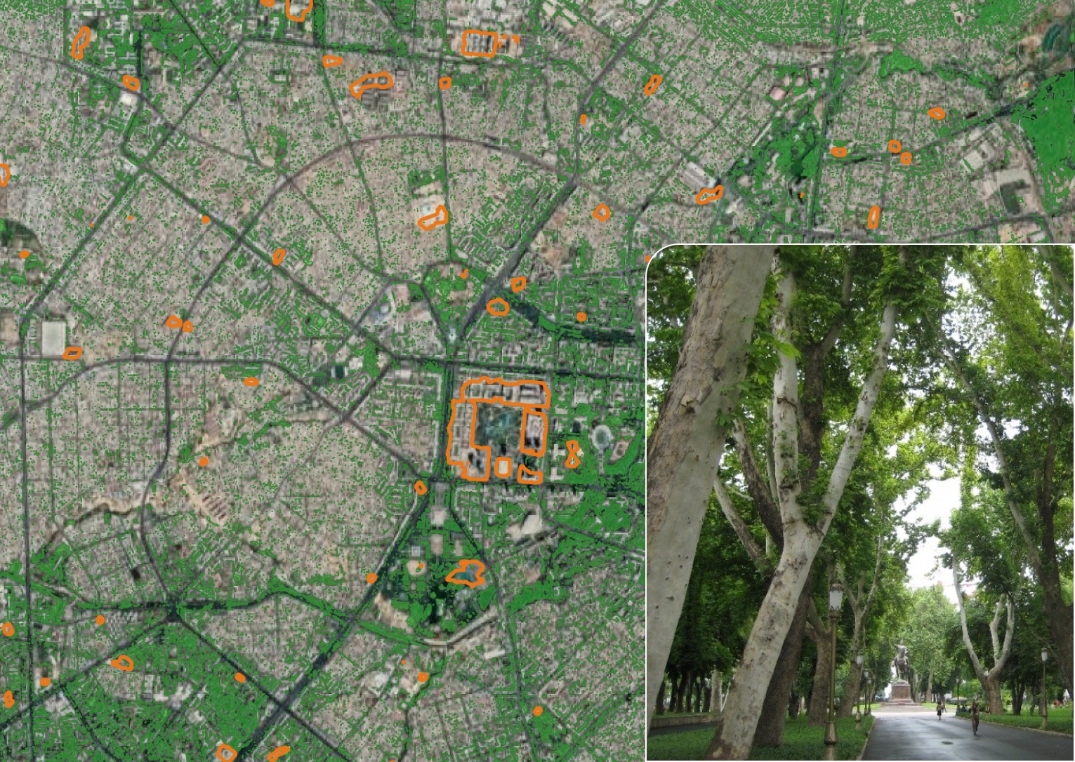
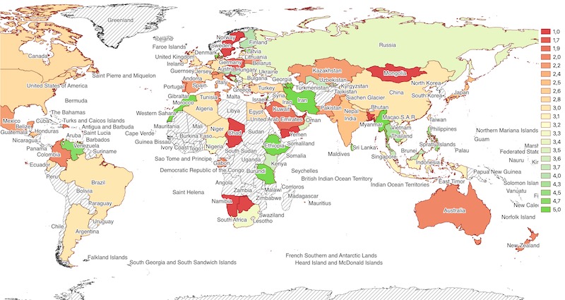
We studied 5 cities in Central Asia: Almaty, Bishkek, Tashkent, Ashgabad, and Dushanbe - which one is the greenest one approved by Earth Observation and AI-mapping
February 09, 2023
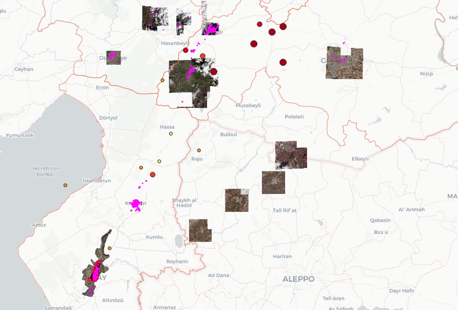
MAXAR keeps on publicly releasing imagery of the affected areas to support response efforts in Turkey-Syria. How you can check if the image is available under the Open data and download it by image ID...
January 09, 2023
At the beginning of the year, we looked back to highlight some milestones in our company life, business, and product development. We’re thankful to our customers, partners, and users for their inspiration, feedback, and support.
December 30, 2022
Looking back at the past year 2022 we decided to write about Mapflow users' feedback ⭐️ To tell the truth we underestimated how insightful this feedback could be. We commit not to leave the free users’ feedback unresponded and will do our best to suggest the solution in case of the issues. Take a look into our Mapflow feedback research.
December 16, 2022
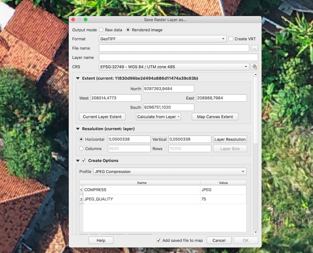
We started publishing userguides collecting useful tips on how to work with Geospatial imagery using #Mapflow and some of open source technologies. ❗️Tell us if you have more tips to share with the community or want to suggest other topics to shed the light on – we are ready to help.
October 26, 2022
The Program is targeting educational and scientifc organizations and provides them with advanced AI tools for remote sensing data analysis. According to this Program, educational organizations could use Mapfow AI-Platform for scientifc research for free and with a special discount of up to 60%.
October 01, 2022
It's the option to increase the model quality spending relatively small amount of manual work. We use the active learning and other approaches to find the best way and find out the trade of between your data requirements and the additional work / expenses to be applied.
August 31, 2022
The streaming services that can be integrated into third-party workflows and applications are definitely the new and trending business model. However, the reality is that the major part of this data is still distributed as files. Go on to catch the new fascinating opportunities…