
My Imagery updated! 🛰️ Organise your data collections and run AI workflows in one shot. 🚀
Mapflow Web App
Run AI-mapping workflows directly in your browser. Extract real-world objects from satellite imagery, view results on an interactive map, and export to GIS-ready formats.
What You Can Do
A complete browser-based platform for AI-powered geospatial analysis and object extraction from satellite imagery.
AI Models
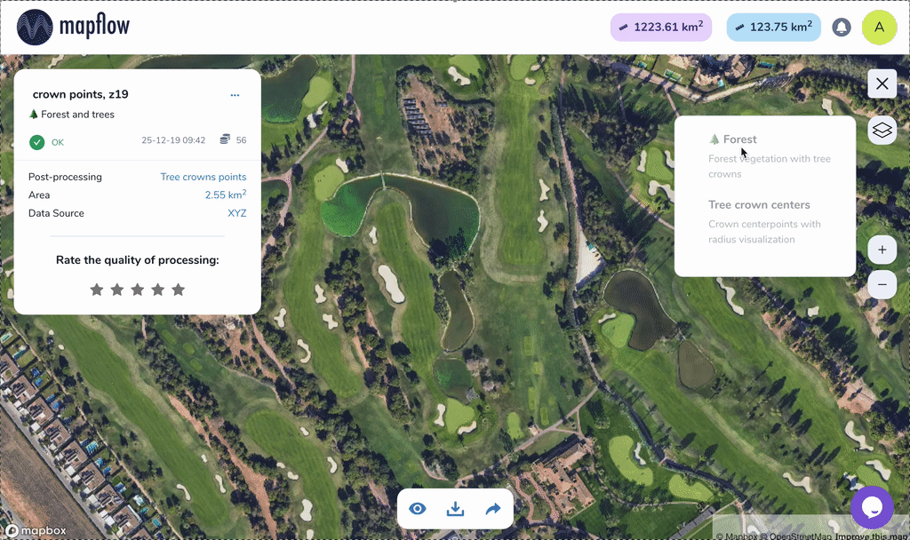
Detect buildings with type classification (residential, commercial, industrial), map forests with height classes, extract roads, and identify construction sites. Combine multiple models in a single run.
Imagery Sources
Choose from built-in providers like Mapbox Satellite, ArcGIS World Imagery, and Global mosaic. Add custom XYZ/TMS tile services with optional authentication. Upload your own GeoTIFF images.
Imagery Search
Search for available satellite imagery over your area of interest. Filter by date range and discover historical data from global providers to find the best image for your analysis.
Post-processing Options
Fine-tune results with model-specific options: building classification, height estimation, contour simplification and regularization, merge with OpenStreetMap data, and vegetation height classification.
Projects & Teams
Organize work into projects with custom icons and model configurations. Share projects with coworkers for view or edit access via Team accounts. Track billing history across your team.
Interactive Results
View processing results on the built-in interactive map with layer switching and legend. Inspect feature attributes including area, class, and height. Rate results to help improve models.
Export & Integrations
Download results as GeoJSON. Open directly in geojson.io for quick editing or in Kepler.gl for advanced visualization. Use the REST API to integrate Mapflow into your own applications.
Flexible AOI
Define your area of interest by drawing a rectangle or polygon on the map, uploading a GeoJSON file, or using the extent of your uploaded GeoTIFF image.
Get Started for Free
Register and receive 250 free credits to test the platform. No credit card required.