
Mapflow Imagery Search

🚀 We are launching a major update to Mapflow's satellite imagery search.
Why Mapflow Search is not yet another commercial imagery marketplace with carts and checkouts?
A bit of history
About five years ago, we began integrating Mapflow AI tools with Maxar SecureWatch --- then the most advanced imagery access platform. Not because of the API (which was a bit messy), but because of its business model: streamed access to the world's largest and constantly updated imagery archive.
Since then, Maxar has changed platforms, partners, APIs, and brand names. Meanwhile, we shifted focus to the massive capacity of Chinese satellite operators to power Mapflow AI with data at scale. 😎
We also built a long-standing integration with Roscosmos --- a surprising case where, despite offering far less competitive data globally, their platform proved more advanced and technically mature than many U.S. or Chinese partners. However, in the end, data quality, volume, and policy define the real value, and that's where we stay focused.
So what?
Mapflow's mission is not to become another storefront for imagery. Our purpose is to be your imagery analysis and mapping AI assistant --- the tool you rely on to turn satellite data into information.
That's why we invest in seamless integrations with data platforms, rather than building a marketplace. Our job is to bring imagery into your workflow, not to distract you with catalog and data purchases.
While you need a subscription to enable ordering of all the commercial imagery and run analytics, with this model it costs you much less than dealing with the data purchasing in the way of data marketplaces. The credits you get within the package can be spent flexibly on data and analysis.
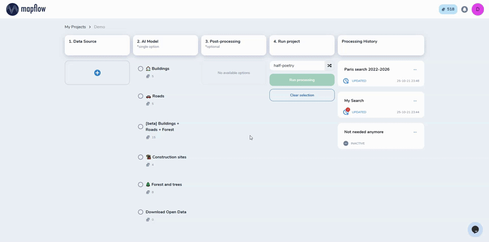
What's inside the updated imagery search
- Basemap Search --- Start analyzing instantly with basemaps, including WorldView imagery and Global Mosaic, searchable by area and timeframe.
- Commercial Data Integration --- We expanded image availability through a partner platform connected to leading commercial satellite operators. This gives you a dramatically wider choice of recent, high‑resolution imagery from a large mix of sensors.
- Search Updates (New!) --- Stay notified when new imagery intersects with your areas of interest --- with virtually no limits on the search extent. If your AOI is too large for a direct API query, Mapflow automatically splits it into manageable chunks and runs searches in the background, merging the results back into a single context for your polygon(s).

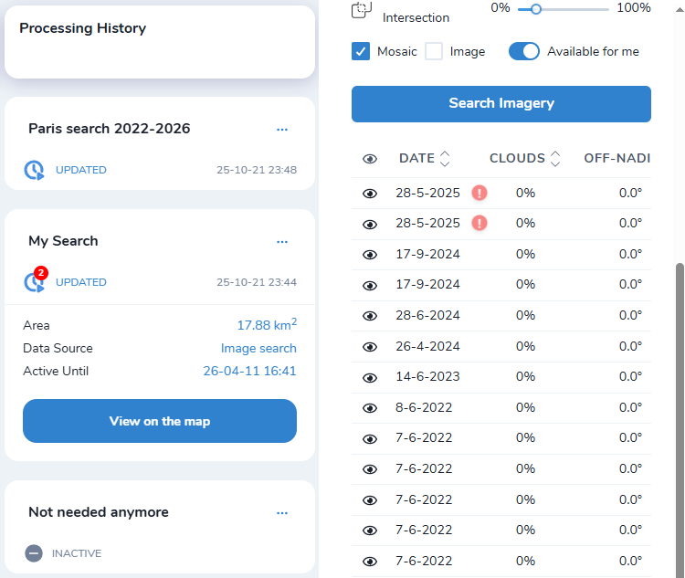
With the new search, you can instantly check what imagery exists, what's upcoming, and decide whether you need a commercial subscription --- or whether basemaps are enough. You should search, preview, and analyze imagery directly --- and get to the information you need faster.
Originally published on Medium