
Is there a building in the image? Validating 1M address points with Mapflow
The question
A customer asked us to validate hundreds of thousands of address points: is there actually a building at the address location? After a few visual checks it became evident that addresses get registered before construction, points drift off the roof onto the street, and plots are demolished or never built. The only source of truth everyone accepts is the aerial image.
We tested an approach on a city of about 8,000 address points in southern Israel, with a 2025 orthophoto at 0.20 m per pixel, provided by the customer. The goal was a method that scales to the whole country, optimises the costs, and hands people only the points that really need a human eye.
How it works: Mapflow as the label factory
The obvious approach is to run Mapflow Buildings over the whole country and check which address points fall inside a footprint. It works, and it was our baseline. But the question is about points, not footprints, and points are what we can make cheap.
So Mapflow takes a different role: it became the label factory. We run the Buildings model on a stratified sample of areas (cities, villages, kibbutzim, new neighbourhoods), intersect the footprints with the address points there, and get hundreds of labelled examples. Each address becomes a small image chip, 49 m across, with a label: building at the point, or not.
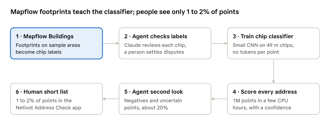
An agent then checks those labels against the chips, because the Buildings model behind the labels makes mistakes too, and a small CNN trained on the corrected dataset scores every address in the country. The agent takes a second look at every negative and every uncertain point; only what it still can't call reaches human validation.
What the city area showed
Trained only on Mapflow's labels, the chip classifier matched the footprint method point for point. We scored both against ~350 points labelled by eye from the imagery, blind to either method's answer.
To estimate the project at scale we built a convex hull around the points. Yes, the application of the Buildings model to the whole country causes overheads. To estimate the cost, we used the ratio of the convex hull area to the total building footprint area extracted by Mapflow (you can call it a built-up area) in Netivot and extrapolated it to the full processing volume for Israel, including a 5% overhead. As a cross-check, CBS (Israel statistics, 2019) land-use figures put built-up land at 5.6% of Israel's 22,072 sq km, about 1,236 sq km. A sparse rural spread with an overhead could reach 2,200 sq km. So the Mapflow Buildings model run could cost around $2,200. As the classification model trained for this case is much cheaper to run, the estimate for its use would be $100 for labels + $700 for the model run.
| Method | Accuracy vs. imagery audit | Cost to run on 1M points |
|---|---|---|
| Mapflow Buildings + point intersect | 96.6% | ~22,000 credits |
| Chip classifier trained on Mapflow labels | 97.0% | ~1,000 credits for labels + 7,000 credits model run |
The difference is within the margin of error. What changes is the cost: Mapflow processes a 100 sq km sample instead of the whole country, and the classifier carries the rest.
The remaining errors cluster in a few places. About 17% of the "no building" answers had a building a few metres off the point, the classic address pin dropped on the street or in the yard. A second look at every negative and uncertain point (18% of Netivot) sorted most of them out, and left 104 points, 1.4% of the city, that needed a person: 69 too ambiguous to call and 35 building sites, where the customer's rule decides.
The human step: the labelling tool for Address Check
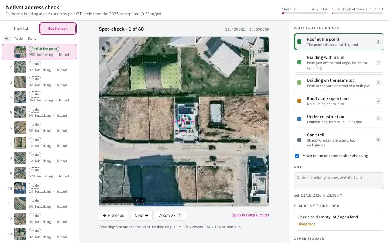
The last 1–2% of the uncertain points (remember, we estimated this ratio based on the testing city area) go to a reviewer in a small web app. Each point opens centred on a 114 m view of the orthophoto, with rings at 5 m and 10 m. One keypress files it in one of six classes: roof at the point, building within 5 m, building on the same lot, empty lot, under construction, or can't tell. Labels are shared, so a team can split the list, and export as CSV or GeoJSON. Each point is marked as a true positive (a building is there) under two rules, a strict one that counts only a roof under the address point and an approximated one that also counts a building within 5 m or on the same lot: "roof at the point" and "building on the lot".
The app also keeps the agent honest. A second queue holds 60 random points the agent already decided; its answer stays hidden until the reviewer chooses, so the spot-check measures how often the agent is right. In the recording below, the first spot-check point is a roof the agent had called an empty lot.
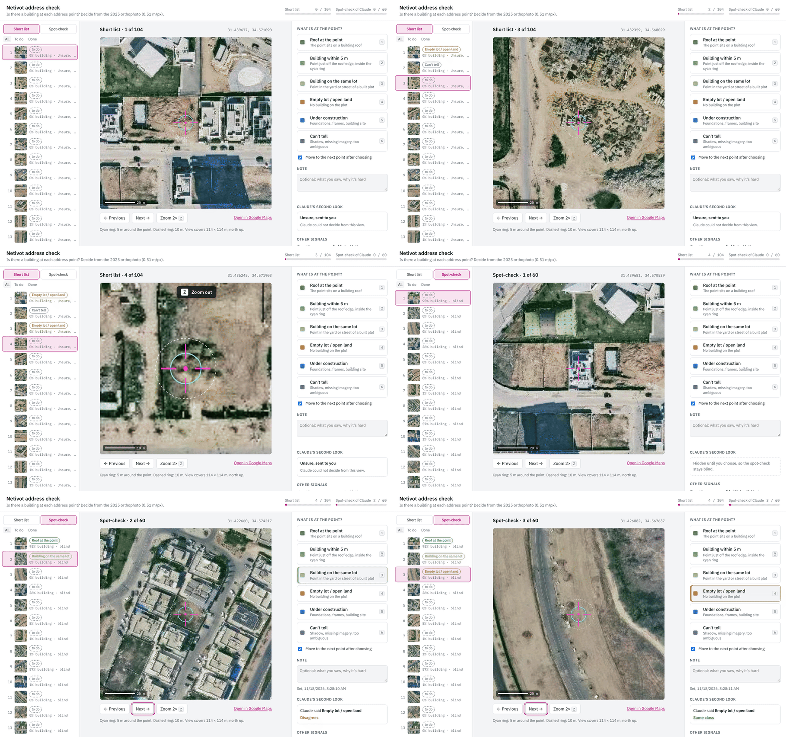
Labelling the short list. The agent's call appears only after the human reviewer decides.
At national scale, and what comes next
For one million addresses, about 2,200 sq km of built-up buffered land, the estimate is roughly $800 in tools and 20–30 hours of human review with the labelling tool. The workflow:
- Mapflow labels: buildings on a 100 sq km sample, about 1,000 credits.
- Mapflow Agent checks: label review and second check.
- Classifier: training, scoring and running the model, about 7,000 credits.
- Imagery: the national orthophoto is free here, as it's available to the customer and can be provided as an XYZ connection to Mapflow.
Running the Mapflow Buildings default model over the whole country would add about 12,000 credits for the same accuracy and many hours of computational time. So you don't need it for the classification task if you don't need the building footprints themselves. But if you do – we'd appreciate it, contact us.
We bring this workflow into Mapflow MCP as a general validation check: give it a point layer and an imagery source, and Mapflow produces the training labels, the agent trains and runs the chip classifier, takes the second look, and opens a review queue for whatever is left. Address registries are the first case; the same pattern fits any register of things that should be visible from above: fuel tanks, solar panels on the roofs, trees in the city green registry, you name it. 😎